Agronomists and crop advisors
Index maps and prescriptions for several growers' fields.
Questions about a project? Our team can help. Contact us →
DJI Terra is DJI's desktop mapping software. On a farm it turns Mavic 3 Multispectral images into reflectance and vegetation-index maps, builds 2D field and fruit-tree maps for Agras route planning, and makes variable-rate prescription maps for Agras spraying. It runs on a Windows PC with an NVIDIA graphics card. We quote the licence that fits the work: Agriculture for most farms, Standard or Flagship when you also need 3D models or LiDAR.
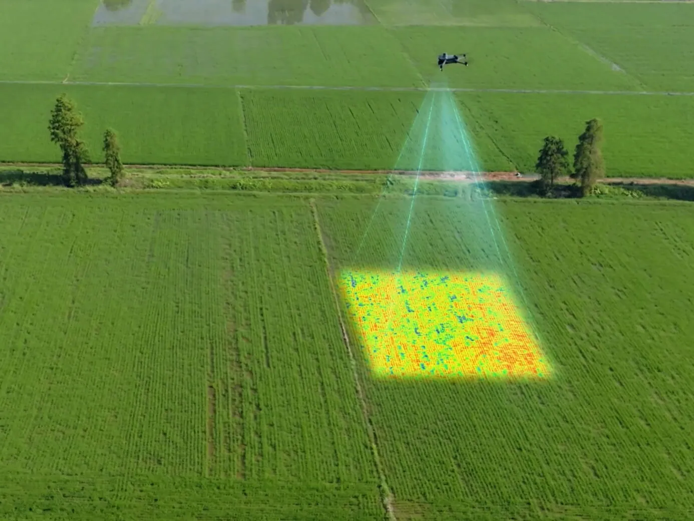
NDVI and GNDVI (overall crop vigour), NDRE and LCI (nitrogen and chlorophyll in dense canopies) and OSAVI (early crops with bare soil showing), from Mavic 3 Multispectral or Phantom 4 Multispectral images, with radiometric correction and reflectance maps so flights on different days compare.
Builds variable-rate prescription maps from multispectral or visible-light maps for Agras spraying and spreading. An agronomist sets the rates; test the file on the controller before the full job.
The Field and Fruit Tree scenarios make 2D maps and route plans designed for the Agras T50 and T100, so boundaries and tree rows come from imagery instead of walking the field.
Agriculture covers the farm features on up to three computers for a year. Standard adds 3D models, LiDAR and terrain; Flagship adds advanced 3D and power-line tools that farms rarely need.
Index maps and orthomosaics export as GeoTIFF, so they open in GIS tools and many farm-management programs as well as on Agras controllers.
Imagery stays on your computer. Plan on Windows 10 or later, 32 GB of RAM and an NVIDIA card with at least 4 GB of video memory.
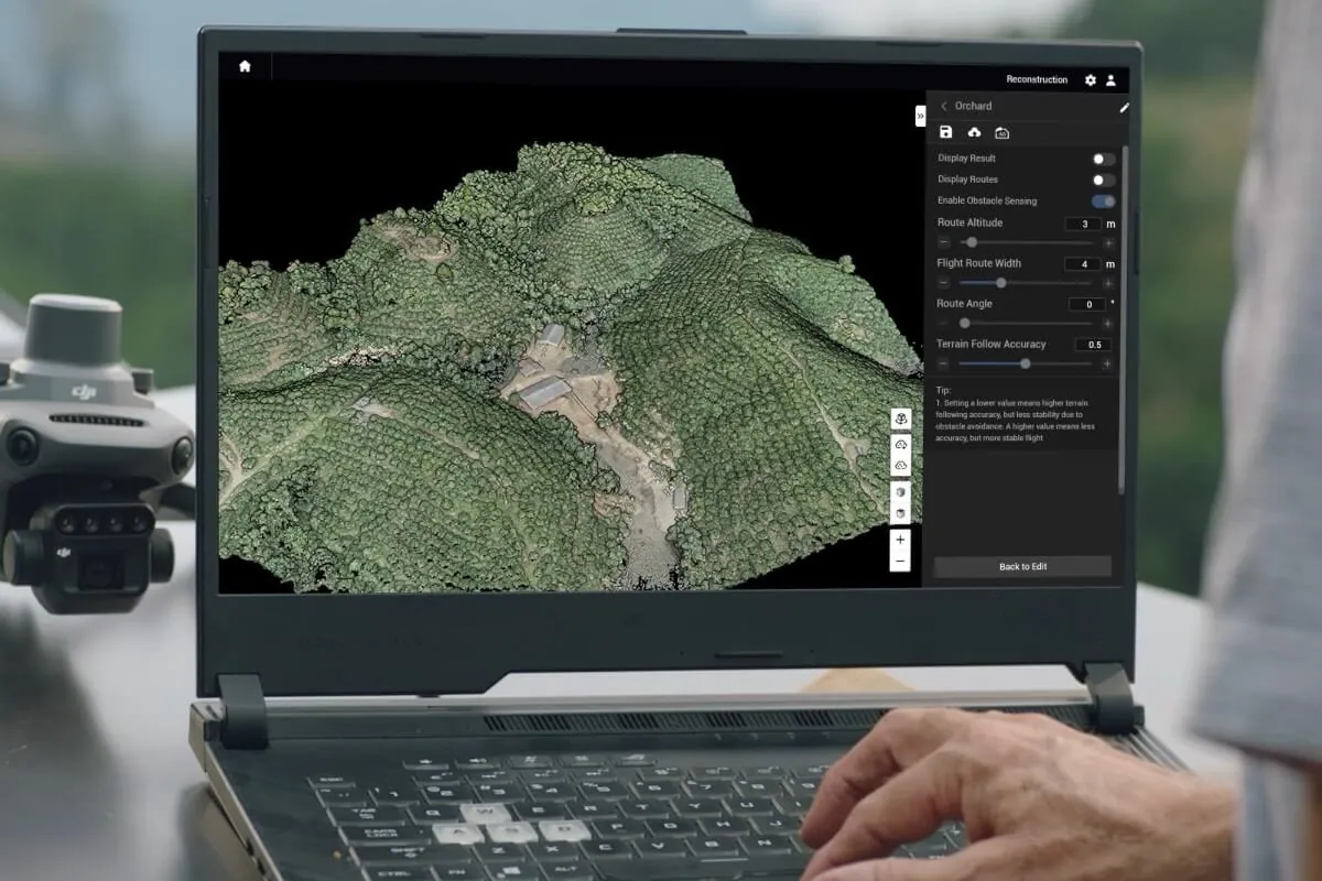
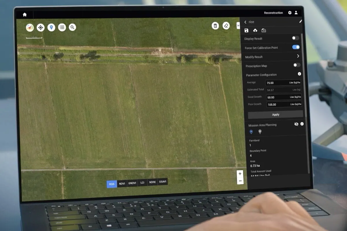
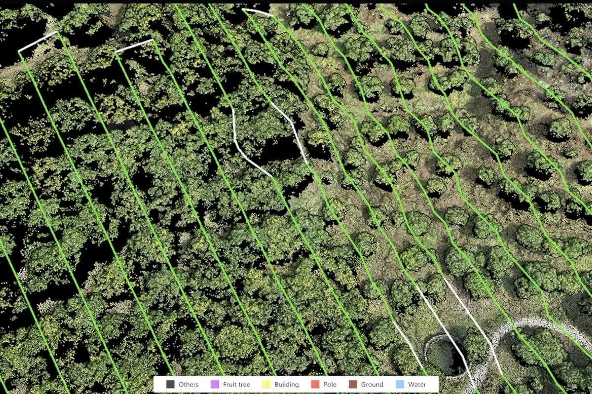
Terra is worth it when someone will process imagery regularly and act on it: index maps for scouting, prescriptions for an Agras, or season-long research data. For a quick look at a field, the Mavic 3M's live NDVI view may be enough.
Index maps and prescriptions for several growers' fields.
Calibrated reflectance and repeatable index maps for plot trials. See institutional purchasing.
Prescriptions for fertilizer, seeding or spraying with an Agras.
Mapping as a service between spray windows.
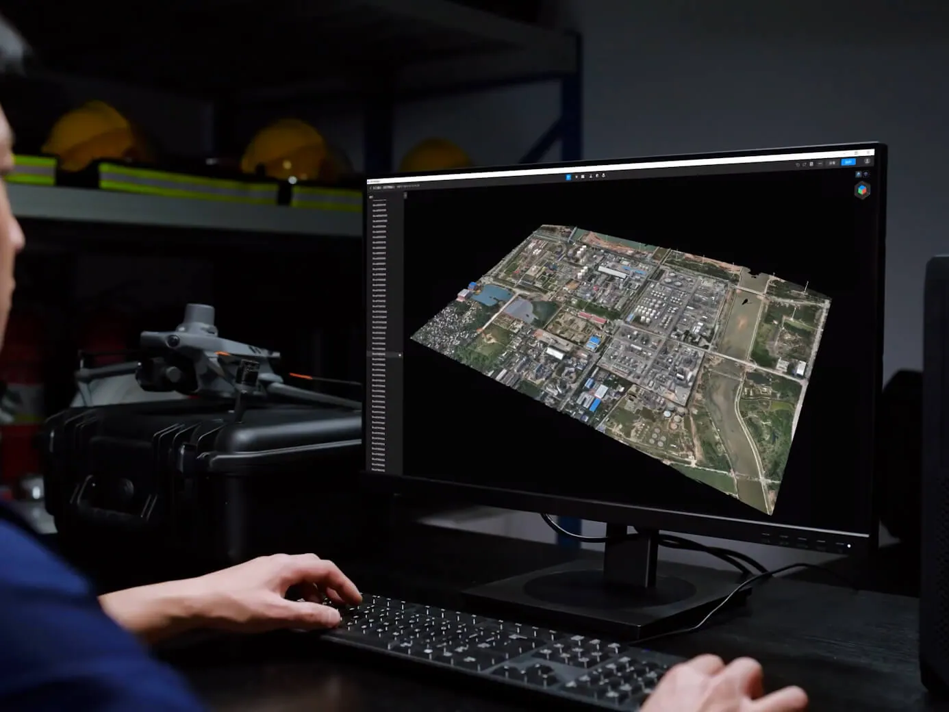
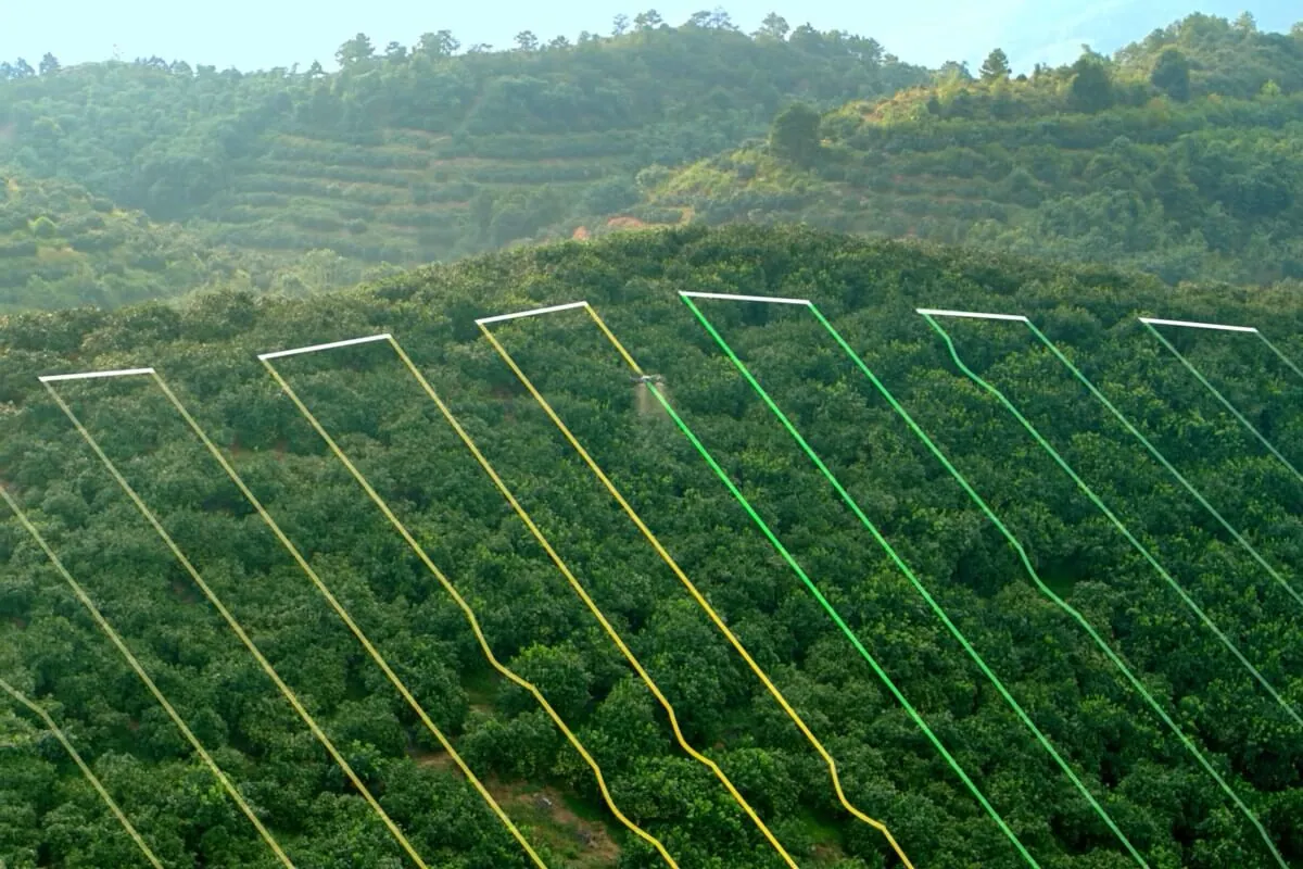
Turning Mavic 3 Multispectral images into reflectance and vegetation-index maps, building field and orchard maps for Agras route planning, and making variable-rate prescription maps for Agras spraying and spreading.
The Agriculture licence covers multispectral and index maps, field and fruit-tree maps and prescriptions, on up to three computers for one year. Choose Standard or Flagship only if you also need 3D models, LiDAR or survey outputs.
No. DJI Terra runs on Windows 10 or later (64-bit) and needs an NVIDIA graphics card; macOS and AMD graphics aren't supported.
Windows 10 or later, 32 GB of RAM and an NVIDIA graphics card with at least 4 GB of video memory, such as a GTX 1050 Ti or better. Larger projects run faster with more memory and a stronger card.
Yes. Terra builds variable-rate prescription maps for Agras spraying from multispectral or visible-light maps. Have an agronomist approve the rates, then check the import and units on the controller with a small test. See crop scouting and mapping.
SmartFarm Web is DJI's web platform: it finds field borders, makes NDVI prescription maps and syncs them to spray drones. Terra runs on your own PC and adds radiometric multispectral processing and more outputs. DJI says either can make index and prescription maps from Mavic 3M data; SmartFarm isn't offered in every country, so ask us what's available in Canada.
It depends on the edition, the number of devices and whether the licence is for one year or permanent. We send an itemized quote, alone or with a Mavic 3 Multispectral kit. Ask for a quote.
The Mavic 3M is a compact mapping drone with a 20 MP RGB camera, four 5 MP multispectral bands (green, red, red edge and near infrared) and a sunlight sensor for consistent readings. Growers, agronomists and researchers use it for NDVI and NDRE maps, to find problem areas and to build prescription maps for Agras application. It weighs under 1 kg and flies up to 43 minutes.
Learn more →Spray and spreading droneThe Agras T50 is DJI's mid-size agricultural drone: one aircraft that sprays from a 40 L tank or broadcasts seed and granules from a 75 L spreader. Canadian growers and custom applicators use it for fungicide passes, cover-crop interseeding and fertilizer top-dress where a ground rig can't get in or would cost an extra pass. We quote it as an itemized package and help you set it up for your fields.
Learn more →Tell us your drone, your PC and the maps you need, and we recommend an edition and quote it.