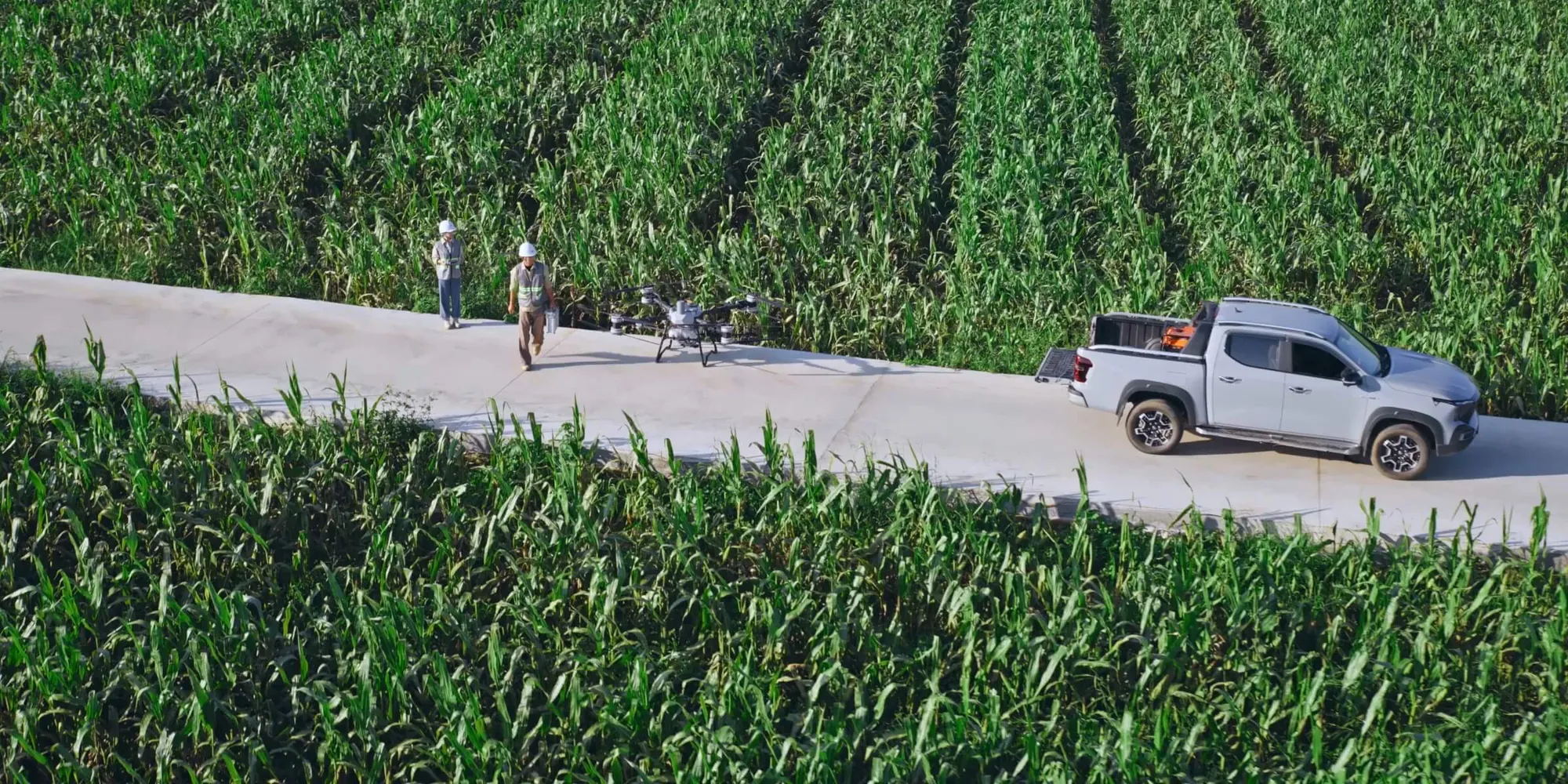
Canadian trials show where drones help with access and timing, and where payloads, refills, weather, data and rules limit the decision.
Agricultural drones can apply liquid, spread dry material or map a field, but the right choice depends on the task. Wet or irregular access can favour a defined application job, while maps guide scouting without diagnosing causes. Payloads, refills, weather, data, labels and Canadian operating rules decide whether ownership fits. Use the agricultural drone guide to start.
What work can an agricultural drone do?
Agricultural drones on a Canadian farm can apply liquid, spread dry material or map a field. Application aircraft need material handling, power, calibration and a workable crew plan. Mapping aircraft need repeatable imagery, processing and ground observations. The deliverable determines which aircraft and workflow deserve review.
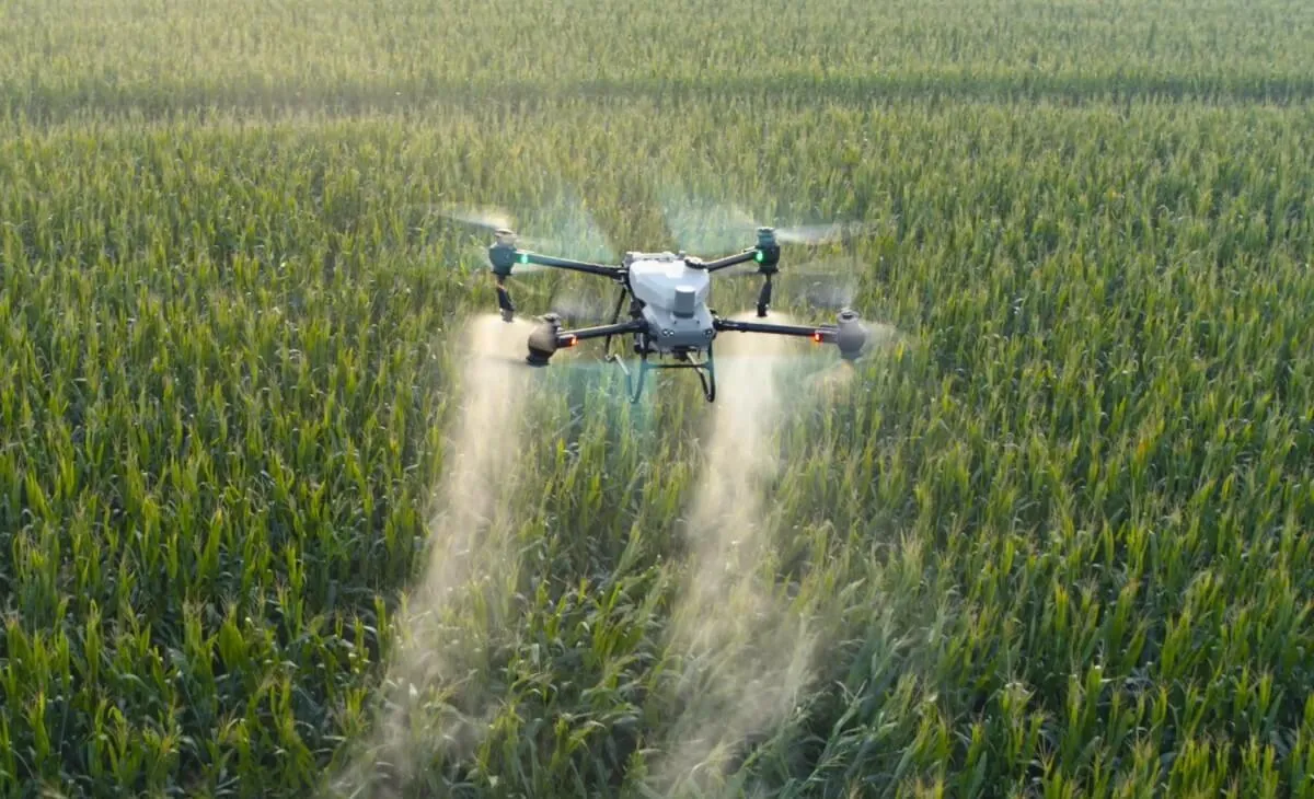
Application work
Application drones fit a defined task that has a permitted material and a field plan. Liquid and dry systems have different handling and payload limits, so an Agras T50 or Agras T100 choice follows the material and job rather than a general preference. Field obstacles, provincial permissions and Transport Canada requirements belong in the check.
Mapping work
Mapping drones produce repeatable imagery for scouting, sampling and repeat observations when the team has a capture and processing plan. The Mavic 3 Multispectral suits a mapping deliverable that combines imagery with ground observations. Pairing a mapping aircraft with application belongs only when a validated map and agronomy plan improve how material is applied.
Start with the field question
An agricultural drone purchase starts with the task and the result the team must deliver. A buyer comparing agricultural drones can begin with the job use cases, then check whether the work needs liquid handling, dry spreading or repeatable imagery. Pairing aircraft belongs only when the map and agronomy plan have been validated.
When can a drone reach ground that equipment cannot?
Drone access and timing matter when ground equipment cannot enter a field at the right moment. Québec observations describe clover interseeded into established fall-seeded cereals when wet ground limited equipment access. Ontario trials tested cover crops in standing corn and soybeans. Granular fertilizer can fit a defined wet or irregular zone.
Wet ground
Drone seeding in Québec is described in MAPAQ's Montérégie field note on producer trials that interseeded clover into established fall-seeded cereals. The agronomist reported broadly even emergence in the fields observed. Producers were considering seeding when wet ground limited equipment access, which makes access the decision point rather than a general claim about every field.
Standing crops
Drone seeding of cover crops was tested by Ontario Living Lab work in standing corn and soybeans across 12 sites, split equally between corn and soybeans, all seeded with DJI Agras T50. At one corn site, drone-seeded rye was more advanced before winter and produced more biomass by spring termination than the other methods described.
Granular passes
Granular fertilizer by drone fits a defined nutrient pass in an accessible zone of a wet or irregular field. A ground machine remains the comparison for high rates and broad, accessible blocks. Material fit, site survey and calibrated setup determine whether spreading belongs in the plan. The drone seeding guide can help frame that decision, alongside the broader use cases.
What can a field map tell me?
A field map from a mapping drone shows spatial patterns in reflected light and can guide scouting, sampling or repeat observations. A vegetation index map does not diagnose water, nutrients, disease or another cause. Crop stage, field history and ground measurements remain part of the decision, so the map answers where to look, not why.
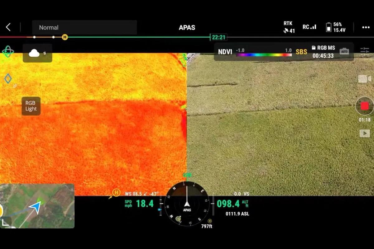
Map the question
A mapping drone workflow needs a repeatable capture plan, a processing plan and ground observations. The Mavic 3 Multispectral fits a deliverable based on repeatable imagery, but the aircraft alone does not create an agronomy answer. A field question should specify the crop stage, field history and ground measurements needed for interpretation.
Check flight limits
Drone flight time for mapping is represented by DJI's 43-minute flight reference, a windless test flown to 0% battery. Field conditions, flight reserves and a realistic turnaround belong in the plan. The Mavic 3M is not waterproof, so weather and recovery need attention.
Use the map with ground work
A crop scouting and mapping workflow connects imagery with observations in the field. The crop scouting guide helps frame the work around a field question, while a validated map and agronomy plan are needed before pairing mapping with application. Reflected light alone cannot identify the cause of a pattern.
How much payload and crew work are involved?
Application drone payload and crew cycles set the practical limit for a farm job. Tank and hopper figures are equipment reference limits, not completed work. Refills, battery rotations, charging, travel, permissions, weather and reporting remain part of the cycle. A catalogue maximum cannot tell a farm how much work its crew can finish.
Read the equipment limits
The Agras T50 application drone lists a 40 L tank with a 40 kg maximum and a 75 L hopper with a 50 kg maximum for 0.5–5 mm dry granules. The Agras T100 lists a 100 L tank with a 100 kg maximum in standard LS100 and a 150 L hopper with a 100 kg maximum.
Plan the crew cycle
An application crew cycle includes rotations against observed cycle times, compatible charger input, generators or mains, safe cable handling, refill capacity, water where relevant, transport, loading ergonomics, spares and cleaning. The field kit guide keeps those planning points together. Volumes, payloads and flows do not establish lawful material use, field rate, accuracy or throughput. Actual product and calibrated setup verify field performance.
Check loaded weight
A loaded application drone's weight can change the operating path. DJI lists a 175 kg maximum takeoff weight for the standard T100 spray or spreading configuration and 177 kg for a spray configuration with four nozzles. An operation above 150 kg actual operating weight requires an SFOC, including a loaded T100 above that threshold.
Why do seed, product and canopy change the result?
Drone results with seed, product and canopy conditions can vary across a field. Canadian trials report more variable early rye outcomes, patchier establishment than drilling and repeat passes at some sites. Material properties can reduce usable fill or make a material unsuitable. Orchard work still needs drift and deposition testing in the real canopy.
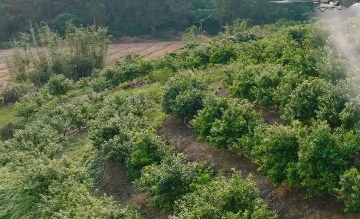
Seed and moisture
Drone seeding of cereal rye into standing grain corn in Québec used target rates of 60–80 kg/ha, and some sites required two drone passes. Canopy interception and limited moisture made establishment more uncertain. Field performance needs verification with the actual seed and a calibrated setup.
Compare with drilling
Drone seeding produced patchier establishment than drilling in the Ontario reporting. A ground seeder or narrow ground spreader remains relevant when placement or soil contact matters. Higher capacity does not fix narrow lanes or tree-row interception, and the choice depends on the field condition and material.
Check the canopy
Drone spray work in orchards needs an on-site survey of wires, trellis, slopes, shelterbelts, people, roads and water margins. A pilot-flown custom application job can be considered when the field needs that work. Actual canopy testing should measure drift and target deposition before relying on the setup.
Should I own the aircraft or have the job flown?
An ownership decision for an agricultural drone depends on the defined work and the capacity for its full workload. A custom application job can be the alternative when a pilot should fly the work. Ownership adds equipment, field kit, training, insurance, licences, software, storage and maintenance. A farm, research team or individual can start with scouting or a scoped trial.
Check the material and rules
Drone chemical application starts with the current pesticide label. Health Canada permits application by a remotely piloted aircraft system, or RPAS, where the label includes applicable RPAS directions or permits aerial use without excluding RPAS, subject to all applicable requirements. No aerial directions or an aerial or RPAS prohibition rules out drone application. Check the Canadian spraying rules and provincial permissions separately.
Compare the full workload
An agricultural drone ownership estimate includes equipment, field kit, training, insurance, licences, software, storage and maintenance. Each job can add pilot and crew time, travel, power, consumables, calibration, weather rework and data processing. A comparison with the same work flown for you keeps the decision tied to actual use. Occasional use can fit scouting or a scoped trial.
Choose a defined next step
A drone custom application job covers spraying, seeding, spreading or mapping after the job is assessed. The assessment checks the product label, field, obstacles, provincial licence, permit, airspace, timing and weather. A buyer who wants to own an aircraft can use the same checklist before choosing a model. The pilot-flown work option keeps the comparison tied to the defined job.
Your next step for an agricultural drone is to describe the crop, material, field and work window on the contact page. Those details help you weigh owning an aircraft against having the job flown for you.
Sources
- MAPAQ Montérégie field note on drone seeding
- Ontario Living Lab drone seeding trials
- Health Canada guidance on drone pesticide application
- Transport Canada drone operation categories and pilot certificates
- Canadian Aviation Regulations, SFOC-RPAS provision
- DJI Agras T50 specifications
- DJI Agras T100 specifications
Frequently Asked Questions
Are drones better than ground sprayers?
Drones are not universally better than ground sprayers. A ground machine remains the comparison for high rates and broad, accessible blocks, while an application drone can fit defined tasks in wet or irregular zones. Material, field access, calibration, provincial permissions and Transport Canada requirements decide the comparison.
Can a drone seed cover crops into a standing crop?
Drone seeding can place cover crops into standing corn and soybeans, but establishment varies. Ontario Living Lab work covered 12 sites, split equally between corn and soybeans, all seeded with DJI Agras T50. Early rye was more advanced before winter at one corn site. Ontario reported patchier establishment than drilling; Québec rye tests sometimes needed two drone passes.
Can any pesticide be applied by drone in Canada?
Pesticide application by drone in Canada is limited by the current pesticide label and other requirements. Health Canada permits RPAS application when the label includes applicable RPAS directions or permits aerial use without excluding RPAS. No aerial directions or an aerial or RPAS prohibition rules out drone application. Provincial permissions and Transport Canada requirements need separate checks.
Does a farm drone need special permission in Canada?
A farm drone may need special permission in Canada, depending on the operation and loaded aircraft. An operation above 150 kg actual operating weight requires an SFOC, including a loaded T100 above that threshold. Pesticide labels, provincial permissions and Transport Canada requirements add separate checks, so a model specification alone does not clear a job.
Is a drone worth it for a small farm?
A drone can be worth considering for a small farm when the job is defined and the workload fits. A single farm or individual buyer can start with scouting, a scoped trial or a defined contract job. Ownership adds equipment, field kit, training, insurance, licences, software, storage and maintenance; occasional use can fit scouting or a scoped trial.
Does a crop health map show what is wrong with the crop?
A crop health map shows spatial patterns in reflected light, not the cause of a crop problem. A vegetation index map can guide scouting, sampling and repeat observations, but it does not diagnose water, nutrients, disease or another cause. Crop stage, field history and ground measurements still shape the decision.